Half day hiking tour up Engelsberg and Größenberg from Winzendorf with an optional climb (UIAA I)
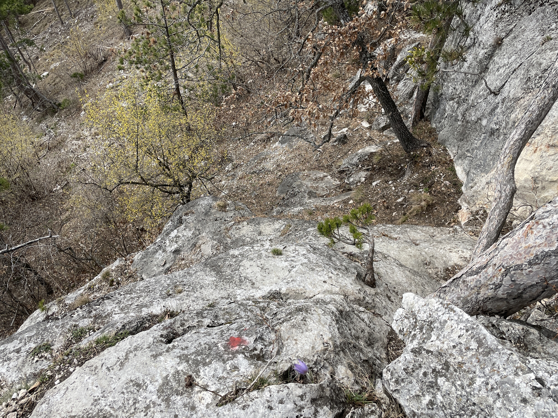
The tour starts at the train station Winzendorf and first crosses the main street and then follows the Winzenstraße for a few meter before turning left into the hiking trail up into the forest and towards Engelsberg. At the big crossing, the wall of the Engelsberg becomes visible and allows for an optional climb (UIAA I) up to the peak. The peak can also be reached without climbing by following the trail straight ahead and then turn right. After enjoying the view from the top of Engelsberg, the route follows the red marked trail further north towards Größenberg and the impressive scenic view from its summit cross (a few meters further). The tour then descends following first the red trail and then turn right into the green marked trail till reaching Bergwiesen. From there the route now follows the blue-yellow marked trail back southwards towards the Eisensteinhöhle. After a well-deserved break at the Eisensteinhöhle hut, the route now continues following the trail southwestwards towards the vineyard, bypasses them using the blue route and then follows the street back to Winzendorf.
| 00:00 | Start at the train station Winzendorf and cross the main street (L87). Then follow the Winzerstraße northeastwards for a few meters. |
| 00:05 | Turn left into the street and bypass the houses, following the trail upwards towards the forest. |
| 00:20 | At the crossing, turn right and continue following the hiking trail upwards. You might consider a detour towards the view point above the stone pit by continuing following the trail straight ahead and then coming back. |
| 00:30 | At the crossing, first keep left and then turn right into the forest road. |
| 00:35 | At the big crossing in front of the Engelsberg cliff, either keep straight and walk around Engelsberg on its left handside or follow the traces to its right and then follow the red dotted marked climbing route (UIAA I). |
| 00:45 | Enjoy the amazing view towards Hohe Wand from Engelsberg. Continue following the trail northeastwards towards the hiking route (normal ascent), cross the forest street and follow the trail a few meters to have another amazing view towards Schneeberg. |
| 01:00 | Enjoy the view towards Schneeberg from the viewpoint. Best enjoyed with a self-brought refreshment (). |
| 01:20 | Head back a few meters to the crossing, turn right and descend for a few meters. |
| 01:22 | At the crossing, turn right and follow the marked trail towards Größenberg. |
| 01:25 | At the crossing, first turn left (following the forest road) and then turn right into the marked trail (leaving the forest road). |
| 01:35 | Bypass the summit of Größenberg and continue following the trail for a few meters to its summit cross. |
| 01:40 | Enjoy the impressive view from Größenberg summit cross. Best enjoyed with a self-brought refreshment (). |
| 01:50 | Descend via the marked trail (keep left), and hike around the Zimesberg. |
| 02:00 | A the crossing, keep straight and follow the traces of a trail up to Burgstall. You need to hike around the building on its right handside. Then follow the forest road eastwards for a few meters and then descend via the green marked hiking trail. |
| 02:25 | At Bergwiesen, turn right and follow the street southeastwards bypassing the various houses. |
| 02:35 | Keep right and follow the yellow-blue marked trail southwards. |
| 02:50 | Well deserved break at the Eisensteinhöhle (). |
| 03:50 | Follow the trail southwestwards through the forest. |
| 04:00 | At the crossing, turn left and follow the street for a few meters and then turn right into the hiking trail (alongside the forest) again. |
| 04:15 | Turn right and follow the street alongside the forest. Keep following the road along but not into the forest. |
| 04:30 | At the crossing, turn right and now follow the street back to Winzendorf. |
| 05:00 | Back at the train station Winzendorf, end of the tour. |
General Tour Data
| Area: | Wiener Alpen, Lower Austria, Austria | |
| Distance: | 13km | |
| Ascent: | 545m (1h 30min) | |
| Descent: | 545m (1h 20min) | |
| Highest Pt: | 605m | |
| Lowest Pt: | 306m | |
| Duration: | 3h 30min (without breaks) 5h 00min (with breaks) |
|
| Stop/Rest: | Schutzhaus Eisensteinhöhle (382m) | |
| Equipment: | Backpack with standard hiking equipment Comfortable hiking shoes Snacks, Food and enough water 2x Gipfelbier Sun & Weather protection Camera |
| Download GPX | ||
| O | Tour at outdooractive.com |
At a glance
| Level | easy |
| – UIAA Level (Climbing) [Optional!] | I |
| Technique | |
| Shape / Fitness | |
| Experience | |
| Scenery | |
| Best time in the year | |
|
Jan
Feb
Mar
Apr
May
Jun
Jul
Aug
Sep
Oct
Nov
Dec
|
|


Leave a Reply